
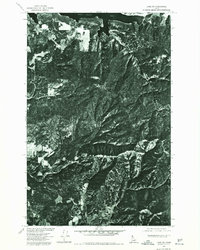
1975 Map of Coeur D'Alene SE
USGS Topo · Published 1977About this map
Coeur D'Alene Lake dominates this mid-1970s orthophotoquad, showcasing the jagged shoreline and deep inlets of the Idaho panhandle. Prepared from aerial photography taken in August 1975, this map provides a detailed photographic view of the landscape rather than traditional topographic contours. In the northern reaches, Mica Bay carves deeply into the western shore, surrounded by a patchwork of timbered hills and small clearings that suggest the era's local land use and private holdings. On the opposite bank, Carlin Creek flows into the lake near an area of concentrated shoreline development. This specific survey was a collaborative effort between the Geological Survey, the Bureau of Indian Affairs, and the Soil Conservation Service, reflecting the complex jurisdictional management of these northern waters and their surrounding natural resources.
Find a feature on this map
3 named features on this map. Tap any name to fly to it.
Don’t see what you’re looking for? This feature index may not catch every label — zoom into the map to look around manually.
Map Details
Editions of this 1975 Coeur D'Alene SE Map
This is the sole edition of this map. No revisions or reprints were ever made.
Other maps of this area

1903 · Rathdrum
USGS Topo · 1:125,000

1955 · Spokane
USGS Topo · 1:250,000

1957 · St. Maries
USGS Topo · 1:62,500

1957 · Plummer
USGS Topo · 1:62,500

1957 · Coeur D'Alene
USGS Topo · 1:62,500

1957 · Lane
USGS Topo · 1:62,500

1958 · Spokane
USGS Topo · 1:250,000

1975 · Plummer NW
USGS Topo · 1:24,000

1975 · Plummer NE
USGS Topo · 1:24,000
1975 · Lane SW
USGS Topo · 1:24,000