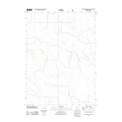
2011 Map of Coffee Mill Butte SE
USGS Topo · Published 2011About this map
Pebble Creek and Pepper Creek define the drainage patterns of this Dawes County landscape, where the rural road network reflects a history of systematic land division and ranching. The presence of Cottonwood School Rd suggests the site of a former community center, while names like Hereford Rd and Scherbarth Rd point to the area's agricultural and family-run ranching roots. The terrain is characterized by the winding paths of Cottonwood Creek and the long, straight stretches of Table Center Rd and Table Rd, which cross the high plains. This 2011 survey, produced with data from the U.S. Forest Service, provides a detailed look at the local geography of the Nebraska panhandle just after the turn of the 21st century.
Find a feature on this map
12 named features on this map. Tap any name to fly to it.
Don’t see what you’re looking for? This feature index may not catch every label — zoom into the map to look around manually.
Map Details
Editions of this 2011 Coffee Mill Butte SE Map
This is the sole edition of this map. No revisions or reprints were ever made.
Other maps of this area

1946 · Box Butte Reservoir West
USGS Topo · 1:24,000

1947 · Box Butte NW
USGS Topo · 1:24,000

1948 · Box Butte Reservoir West
USGS Topo · 1:24,000

1948 · Box Butte Reservoir East
USGS Topo · 1:24,000

1949 · Box Butte NW
USGS Topo · 1:24,000

1955 · Alliance
USGS Topo · 1:250,000

1957 · Alliance
USGS Topo · 1:250,000

1958 · Alliance
USGS Topo · 1:250,000
1966 · Chadron 3 SW
USGS Topo · 1:24,000

1970 · Chadron 3 NW
USGS Topo · 1:24,000