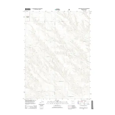
2014 Map of Coffee Mill Butte SE
USGS Topo · Published 2014About this map
Nebraska National Forest lands anchor the northwest corner of this Dawes County survey, where the high plains landscape is defined by a network of drainage creeks and ranch roads. The terrain is marked by the presence of Pebble Cr and Cottonwood Cr, which carve through the topography alongside a grid of section-line and canyon roads. Local thoroughfares like Scherbarth Rd and Hereford Rd serve the rural agricultural community, while the naming of Cottonwood School Rd points to the historical placement of educational hubs in this remote portion of the panhandle. The map reveals the infrastructure of the modern ranching era, including numerous Autogate Rd crossings that signify the continued importance of open-range management and livestock movement in this high-altitude Nebraskan environment.
Find a feature on this map
12 named features on this map. Tap any name to fly to it.
Don’t see what you’re looking for? This feature index may not catch every label — zoom into the map to look around manually.
Map Details
Editions of this 2014 Coffee Mill Butte SE Map
This is the sole edition of this map. No revisions or reprints were ever made.
Other maps of this area

1946 · Box Butte Reservoir West
USGS Topo · 1:24,000

1947 · Box Butte NW
USGS Topo · 1:24,000

1948 · Box Butte Reservoir West
USGS Topo · 1:24,000

1948 · Box Butte Reservoir East
USGS Topo · 1:24,000

1949 · Box Butte NW
USGS Topo · 1:24,000

1955 · Alliance
USGS Topo · 1:250,000

1957 · Alliance
USGS Topo · 1:250,000

1958 · Alliance
USGS Topo · 1:250,000
1966 · Chadron 3 SW
USGS Topo · 1:24,000

1970 · Chadron 3 NW
USGS Topo · 1:24,000