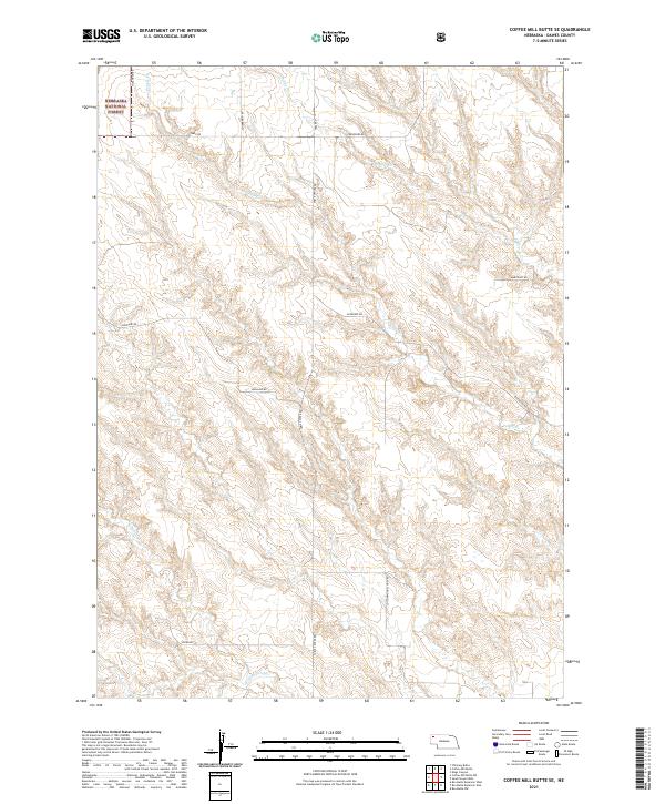
2021 Map of Coffee Mill Butte SE
USGS Topo · Published 2021About this map
The Nebraska National Forest anchors the northwestern corner of this Dawes County landscape, where the high plains terrain is defined by a series of ephemeral watercourses. Intermittent drainage systems including Pepper Creek, Pebble Creek, and Cottonwood Creek carve through the section lines, shaping the local ranching and agricultural layout. The map reveals a strictly rectangular road network typical of the Public Land Survey System, with long-established thoroughfares such as Table Center Rd and Highland Rd providing the primary access through the townships. The presence of Cottonwood School Rd in the southern sections points to the historical locations of rural educational centers that once served the dispersed homesteading community. Other local routes like Autogate Rd and Scherbarth Rd reflect the practical needs of navigating this open range and the family names associated with its development.
Find a feature on this map
20 named features on this map. Tap any name to fly to it.
Don’t see what you’re looking for? This feature index may not catch every label — zoom into the map to look around manually.
Map Details
Editions of this 2021 Coffee Mill Butte SE Map
This is the sole edition of this map. No revisions or reprints were ever made.
Other maps of this area

1946 · Box Butte Reservoir West
USGS Topo · 1:24,000

1947 · Box Butte NW
USGS Topo · 1:24,000

1948 · Box Butte Reservoir West
USGS Topo · 1:24,000

1948 · Box Butte Reservoir East
USGS Topo · 1:24,000

1949 · Box Butte NW
USGS Topo · 1:24,000

1955 · Alliance
USGS Topo · 1:250,000

1957 · Alliance
USGS Topo · 1:250,000

1958 · Alliance
USGS Topo · 1:250,000
1966 · Chadron 3 SW
USGS Topo · 1:24,000

1970 · Chadron 3 NW
USGS Topo · 1:24,000