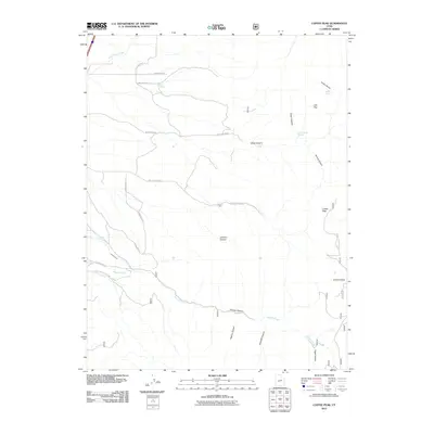
2011 Map of Coffee Peak
USGS Topo · Published 2011About this map
Coffee Peak stands as the central landmark of this high-elevation landscape in Millard County, where a complex network of canyons and springs defines the drainage patterns toward the desert floor below. The map documents an area characterized by seasonal water sources and historical irrigation infrastructure, most notably the Pioneer Ditch which runs alongside Pioneer Creek. These features, along with Indian Spring and Oak Spring, suggest a history of resource management for local ranching and agriculture.
Find a feature on this map
30 named features on this map. Tap any name to fly to it.
Don’t see what you’re looking for? This feature index may not catch every label — zoom into the map to look around manually.
Map Details
Editions of this 2011 Coffee Peak Map
This is the sole edition of this map. No revisions or reprints were ever made.
Other maps of this area

1885 · Beaver
USGS Topo · 1:250,000

1885 · Sevier Desert
USGS Topo · 1:250,000

1953 · Richfield
USGS Topo · 1:250,000

1953 · Delta
USGS Topo · 1:250,000

1958 · Richfield
USGS Topo · 1:250,000

1958 · Delta
USGS Topo · 1:250,000

1961 · Fillmore
USGS Topo · 1:24,000

1961 · Mt. Catherine
USGS Topo · 1:24,000

1961 · Richfield
USGS Topo · 1:62,500

1962 · Delta
USGS Topo · 1:250,000