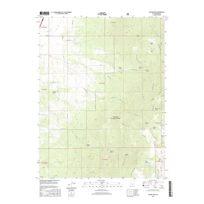
2017 Map of Coffee Peak
USGS Topo · Published 2017About this map
Fishlake National Forest dominates this landscape in the eastern portion of Millard County, where the high elevations of the Pahvant Range create a complex system of drainages and passes. The map identifies Coffee Peak as a central landmark, flanked by the steep descents of Spring Branch Canyon and Maple Hollow. Evidence of early land use and resource management is visible through features like Indian Ranch and the Pioneer G S, while the naming of Pioneer Ditch and Pioneer Cr suggests the historical importance of water diversion for the lowlands. A network of pack trails and forest roads, including the Indian Springs-Scipio Pass and Coal Mine route, illustrates how this terrain was navigated for transit between the high peaks and the Robins Valley floor.
Find a feature on this map
56 named features on this map. Tap any name to fly to it.
Don’t see what you’re looking for? This feature index may not catch every label — zoom into the map to look around manually.
Map Details
Editions of this 2017 Coffee Peak Map
This is the sole edition of this map. No revisions or reprints were ever made.
Other maps of this area

1885 · Beaver
USGS Topo · 1:250,000

1885 · Sevier Desert
USGS Topo · 1:250,000

1953 · Richfield
USGS Topo · 1:250,000

1953 · Delta
USGS Topo · 1:250,000

1958 · Richfield
USGS Topo · 1:250,000

1958 · Delta
USGS Topo · 1:250,000

1961 · Fillmore
USGS Topo · 1:24,000

1961 · Mt. Catherine
USGS Topo · 1:24,000

1961 · Richfield
USGS Topo · 1:62,500

1962 · Delta
USGS Topo · 1:250,000