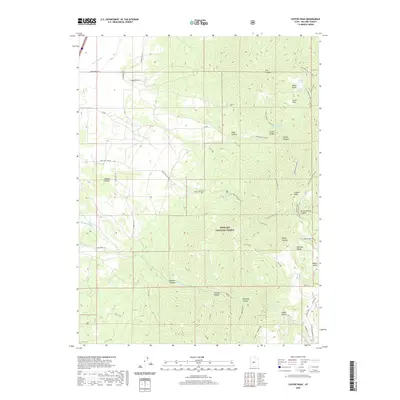
2020 Map of Coffee Peak
USGS Topo · Published 2020About this map
Indian Ranch sits at the northern edge of the high mountain terrain, a rare pocket of settlement in a landscape defined by the deep incisions of the Pahvant Range. The area is part of the Fishlake National Forest, where steep drainages like Teeples Canyon and Jumpoff Canyon fall away from prominent high points such as Coffee Peak. Evidence of local resource extraction appears with a Coal Mine located along the ridges, while the network of trails like Trail 1399 and Trail 1418 suggests a legacy of forest management and backcountry access. Hydrological features such as Bennett Spring and Wide Mouth Spring provide critical water sources in this arid environment, often feeding into named channels like Pioneer Cr or the man-made Pioneer Ditch.
Find a feature on this map
49 named features on this map. Tap any name to fly to it.
Don’t see what you’re looking for? This feature index may not catch every label — zoom into the map to look around manually.
Map Details
Editions of this 2020 Coffee Peak Map
This is the sole edition of this map. No revisions or reprints were ever made.
Other maps of this area

1885 · Beaver
USGS Topo · 1:250,000

1885 · Sevier Desert
USGS Topo · 1:250,000

1953 · Richfield
USGS Topo · 1:250,000

1953 · Delta
USGS Topo · 1:250,000

1958 · Richfield
USGS Topo · 1:250,000

1958 · Delta
USGS Topo · 1:250,000

1961 · Fillmore
USGS Topo · 1:24,000

1961 · Mt. Catherine
USGS Topo · 1:24,000

1961 · Richfield
USGS Topo · 1:62,500

1962 · Delta
USGS Topo · 1:250,000