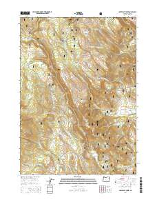
2014 Map of Coffeepot Creek
USGS Topo · Published 2014About this map
Fremont National Forest defines this high-elevation landscape in Lake County, Oregon, where a complex network of drainage systems and springs supports the local ecology. The drainage basin is anchored by Coffeepot Creek, which flows through the center of the sheet, supported by numerous smaller tributaries like Puppydog Cr and Little Coffeepot Cr. These water sources were vital for early forest management and grazing, as indicated by named sites like Coffeepot Spring, Puppydog Spring, and Cold Spring.
Find a feature on this map
34 named features on this map. Tap any name to fly to it.
Don’t see what you’re looking for? This feature index may not catch every label — zoom into the map to look around manually.
Map Details
Editions of this 2014 Coffeepot Creek Map
This is the sole edition of this map. No revisions or reprints were ever made.
Other maps of this area

1955 · Klamath Falls
USGS Topo · 1:250,000

1958 · Klamath Falls
USGS Topo · 1:250,000

1960 · Fishhole Mtn
USGS Topo · 1:62,500

1964 · Coleman Point
USGS Topo · 1:24,000

1964 · Shoestring Butte
USGS Topo · 1:24,000

1966 · Morgan Butte
USGS Topo · 1:24,000

1966 · Slide Mtn
USGS Topo · 1:24,000

1966 · Harvey Creek
USGS Topo · 1:24,000

1966 · Coffeepot Creek
USGS Topo · 1:24,000

1966 · Paisley
USGS Topo · 1:24,000