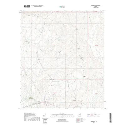
2018 Map of Coffeeville
USGS Topo · Published 2018About this map
The Coffeeville community sits on the eastern banks of the Tombigbee River in western Clarke County, where the landscape is defined by a dense network of creek drainages including Eberline Mill Cr and Elcanush Cr. This 2018 survey reveals a rural topography punctuated by significant family and community landmarks such as Owl Hill and Dunagan Hill. The settlement pattern follows older routes like Old Ferry Rd and Gin Rd, while the numerous burial grounds scattered across the terrain—including Webb Cem, Anderson Cem, and Ulcanush Cem—provide a clear record of local family history and ancestral homesteads. Near the border with Choctaw County, the Folsom Bridge crosses the river, and the elevation rises to the prominent Ball Bluff, overlooking the waterway. The map details a transition from the river bottomlands to the interior uplands of Center Point, tracing the local roads and natural watercourses that have shaped this portion of southwest Alabama for generations.
Find a feature on this map
69 named features on this map. Tap any name to fly to it.
Don’t see what you’re looking for? This feature index may not catch every label — zoom into the map to look around manually.
Map Details
Editions of this 2018 Coffeeville Map
This is the sole edition of this map. No revisions or reprints were ever made.
Other maps of this area

1953 · Andalusia
USGS Topo · 1:250,000

1953 · Hattiesburg
USGS Topo · 1:250,000

1957 · Andalusia
USGS Topo · 1:250,000

1958 · Hattiesburg
USGS Topo · 1:250,000

1971 · Coffeeville
USGS Topo · 1:24,000

1971 · Ararat
USGS Topo · 1:24,000

1971 · Bladon Springs
USGS Topo · 1:24,000

1971 · Coffeeville Lock And Dam
USGS Topo · 1:24,000

1972 · Tattlersville
USGS Topo · 1:24,000

1972 · Woods Bluff
USGS Topo · 1:24,000