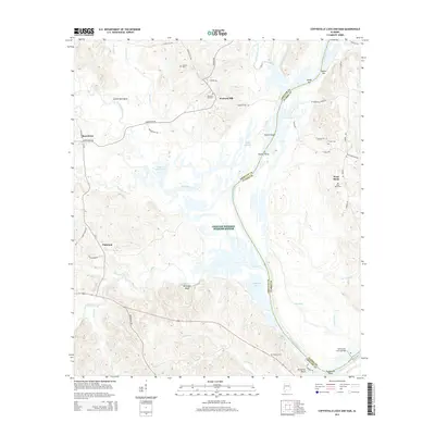
2014 Map of Coffeeville Lock And Dam
USGS Topo · Published 2014About this map
The Tombigbee River forms the central spine of this landscape, marking the boundary between Choctaw and Clarke Counties. The river's historical importance to navigation is underscored by the presence of the Coffeeville Lock and Dam in the south and various river features such as Philans Shoal and Thompsons Shoal. The western bank is largely defined by the Choctaw National Wildlife Refuge, where numerous sloughs and lakes like Coker Bend Lake and Judys Slough create a complex wetland environment.
Find a feature on this map
64 named features on this map. Tap any name to fly to it.
Don’t see what you’re looking for? This feature index may not catch every label — zoom into the map to look around manually.
Map Details
Editions of this 2014 Coffeeville Lock And Dam Map
This is the sole edition of this map. No revisions or reprints were ever made.
Other maps of this area

1953 · Hattiesburg
USGS Topo · 1:250,000

1958 · Hattiesburg
USGS Topo · 1:250,000

1971 · Coffeeville
USGS Topo · 1:24,000

1971 · Ararat
USGS Topo · 1:24,000

1971 · Bladon Springs
USGS Topo · 1:24,000

1971 · Coffeeville Lock And Dam
USGS Topo · 1:24,000

1972 · Tattlersville
USGS Topo · 1:24,000

1972 · Woods Bluff
USGS Topo · 1:24,000

1974 · Millry North
USGS Topo · 1:24,000

1974 · Silas
USGS Topo · 1:24,000