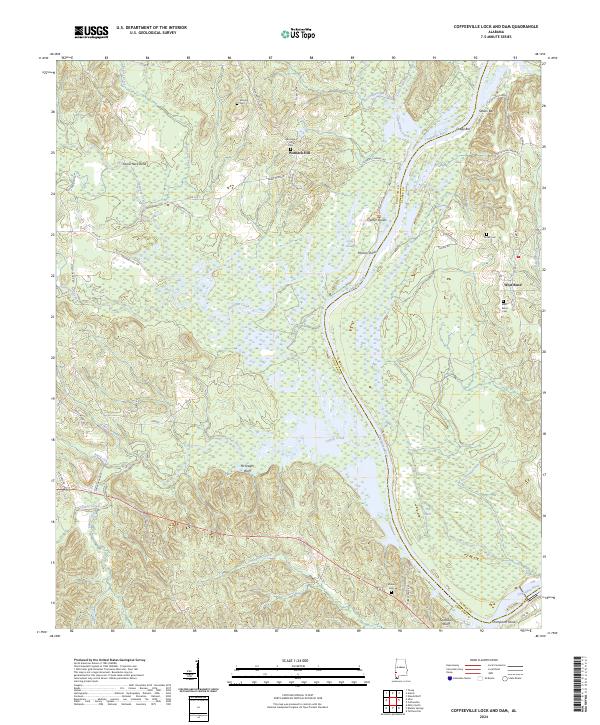
2024 Map of Coffeeville Lock And Dam
USGS Topo · Published 2024About this map
The Choctaw National Wildlife Refuge dominates the central landscape of this western Alabama river corridor, where the Tombigbee River meanders through a complex system of wetlands and riverine landmarks. Historically significant family names and small settlements are scattered across the higher ground, including Womack Hill and West Bend, each associated with established burial grounds like Womack Hill Cem and West Bend Cem. The river's character is defined by navigational features such as Philans Shoal and Sellers Bar, while the western bluffs rise sharply at Mcgregor Bluff. The distribution of cemeteries, including Moores Cem and Moore Cem, provides a clear view of the rural settlement patterns that have persisted along the Choctaw and Clarke county line. This geography remains largely defined by its relationship to the water, from the broad Tombigbee River to tributaries like Okatuppa Creek and Turkey Creek.
Find a feature on this map
69 named features on this map. Tap any name to fly to it.
Don’t see what you’re looking for? This feature index may not catch every label — zoom into the map to look around manually.
Map Details
Editions of this 2024 Coffeeville Lock And Dam Map
This is the sole edition of this map. No revisions or reprints were ever made.
Other maps of this area

1953 · Hattiesburg
USGS Topo · 1:250,000

1958 · Hattiesburg
USGS Topo · 1:250,000

1971 · Coffeeville
USGS Topo · 1:24,000

1971 · Ararat
USGS Topo · 1:24,000

1971 · Bladon Springs
USGS Topo · 1:24,000

1971 · Coffeeville Lock And Dam
USGS Topo · 1:24,000

1972 · Tattlersville
USGS Topo · 1:24,000

1972 · Woods Bluff
USGS Topo · 1:24,000

1974 · Millry North
USGS Topo · 1:24,000

1974 · Silas
USGS Topo · 1:24,000