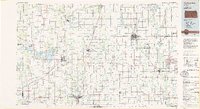
1985 Map of Coffeyville
USGS Topo · Published 1985About this map
The Verdigris River and Neosho River basins define this southeast Kansas landscape, where the convergence of major rail lines shaped a dense network of agricultural and industrial towns. By the mid-1980s, the region supported significant infrastructure, including the Kansas Army Ammunition Plant near Parsons and the Parsons State Hospital. Water management is a primary feature of the terrain, evidenced by the large reservoir at Elk City Lake and the smaller Big Hill Lake.
Find a feature on this map
135 named features on this map. Tap any name to fly to it.
Don’t see what you’re looking for? This feature index may not catch every label — zoom into the map to look around manually.
Map Details
Editions of this 1985 Coffeyville Map
This is the sole edition of this map. No revisions or reprints were ever made.
Other maps of this area

1884 · Fort Scott
USGS Topo · 1:125,000

1885 · Eureka
USGS Topo · 1:125,000

1885 · Sedan
USGS Topo · 1:125,000

1886 · Fredonia
USGS Topo · 1:125,000

1886 · Joplin
USGS Topo · 1:125,000

1886 · Iola
USGS Topo · 1:125,000

1886 · Independence
USGS Topo · 1:125,000

1886 · Fort Scott
USGS Topo · 1:125,000

1886 · Parsons
USGS Topo · 1:125,000

1888 · Eureka
USGS Topo · 1:125,000