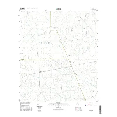
2017 Map of Cogdell
USGS Topo · Published 2017About this map
Cogdell occupies a central position on this 2017 landscape, where the borders of Atkinson, Clinch, and Ware counties converge in the Georgia pine barrens. The terrain is defined by a complex network of wetland features, notably Huckleberry Bay, Bennett Bay, and Buzzard Bay, which feed into local drainages like Suwannee Cr and Perch Creek. This area illustrates a rural settlement pattern where family names are deeply etched into the geography through road labels such as Folks Bennett RD, Mullis RD, and John Dawson RD. Historical community hubs are represented by the presence of Sycamore School RD and Hargraves Church RD, indicating the locations of former local institutions. The physical landscape is further distinguished by the Double Islands and the headwaters of numerous small tributaries including Coon Br and Mill Br, reflecting the intricate hydrology of the region.
Find a feature on this map
54 named features on this map. Tap any name to fly to it.
Don’t see what you’re looking for? This feature index may not catch every label — zoom into the map to look around manually.
Map Details
Editions of this 2017 Cogdell Map
This is the sole edition of this map. No revisions or reprints were ever made.
Other maps of this area

1953 · Waycross
USGS Topo · 1:250,000

1958 · Waycross
USGS Topo · 1:250,000

1967 · Pine Valley
USGS Topo · 1:24,000

1968 · Homerville East
USGS Topo · 1:24,000

1968 · Manor
USGS Topo · 1:24,000

1968 · Cogdell
USGS Topo · 1:24,000

1971 · Axson
USGS Topo · 1:24,000

1971 · Pearson
USGS Topo · 1:24,000

1971 · Talmo
USGS Topo · 1:24,000

1972 · Sandy Bottom
USGS Topo · 1:24,000