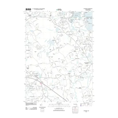
2012 Map of Cohasset
USGS Topo · Published 2012About this map
Old Oaken Bucket Homestead stands as a focal point of local heritage in this coastal Massachusetts landscape, situated near the intersection of various historic villages. The map reveals a dense network of local communities including Beechwood, Scituate Center, and Egypt, connected by winding roads that skirt numerous glacial hills such as Mount Blue and Hoop Pole Hill. The drainage patterns are intricate, with First Herring Brook and Wildcat Brook feeding into North River, which defines the southern boundary of the quadrangle. Genealogists will find significant value in the distribution of burial grounds across the townships, from the First Parish Cem and Old First Parish Cem in Norwell to the Twomile Cem near North Marshfield. The area's transition from a collection of rural hamlets to established residential neighborhoods is evident in the proximity of older homesteads to modern developments like Jacobs Lake Shores.
Find a feature on this map
275 named features on this map. Tap any name to fly to it.
Don’t see what you’re looking for? This feature index may not catch every label — zoom into the map to look around manually.
Map Details
Editions of this 2012 Cohasset Map
This is the sole edition of this map. No revisions or reprints were ever made.
Other maps of this area

1885 · Abington
USGS Topo · 1:62,500

1885 · Duxbury
USGS Topo · 1:62,500

1888 · Duxbury
USGS Topo · 1:62,500

1888 · Abington
USGS Topo · 1:62,500

1892 · Boston Bay
USGS Topo · 1:62,500

1893 · Abington
USGS Topo · 1:62,500

1893 · Duxbury
USGS Topo · 1:62,500

1903 · Boston Bay
USGS Topo · 1:62,500

1918 · Duxbury
USGS Topo · 1:62,500

1920 · Abington
USGS Topo · 1:62,500