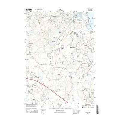
2015 Map of Cohasset
USGS Topo · Published 2015About this map
Old Oaken Bucket Homestead stands as a focal point of cultural heritage in this coastal Massachusetts landscape, surrounded by a dense network of early crossroads settlements. The transition from the rugged shoreline at Minot Beach to the interior wooded hills reveals a pattern of historic land use, from the maritime infrastructure of Government Island to the inland agricultural and residential clusters of Beechwood and Scituate Center. Water shapes the terrain significantly, with First Herring Brook and the North River carving through the lowlands, while numerous ponds like Foundry Pond and Tack-Factory Pond hint at the area's early industrial legacy.
Find a feature on this map
120 named features on this map. Tap any name to fly to it.
Don’t see what you’re looking for? This feature index may not catch every label — zoom into the map to look around manually.
Map Details
Editions of this 2015 Cohasset Map
This is the sole edition of this map. No revisions or reprints were ever made.
Other maps of this area

1885 · Abington
USGS Topo · 1:62,500

1885 · Duxbury
USGS Topo · 1:62,500

1888 · Duxbury
USGS Topo · 1:62,500

1888 · Abington
USGS Topo · 1:62,500

1892 · Boston Bay
USGS Topo · 1:62,500

1893 · Abington
USGS Topo · 1:62,500

1893 · Duxbury
USGS Topo · 1:62,500

1903 · Boston Bay
USGS Topo · 1:62,500

1918 · Duxbury
USGS Topo · 1:62,500

1920 · Abington
USGS Topo · 1:62,500