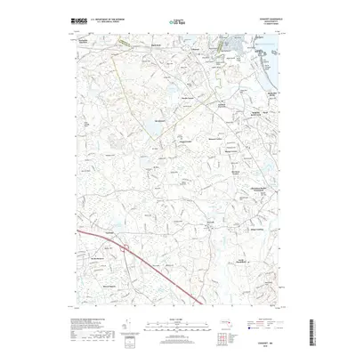
2018 Map of Cohasset
USGS Topo · Published 2018About this map
Cohasset and the surrounding South Shore communities of North Scituate and Norwell are defined by an intricate network of coastal wetlands and glacial drumlins. The landscape is a dense assembly of historically significant sites, including the Old Oaken Bucket Homestead and various burial grounds such as the Old First Parish Cem and Merritt Cem. Water is a constant presence, from the tidal reaches of the North River at Kings Landing to the interior basins of Bound Brook Pond and the Aaron River reservoir.
Find a feature on this map
257 named features on this map. Tap any name to fly to it.
Don’t see what you’re looking for? This feature index may not catch every label — zoom into the map to look around manually.
Map Details
Editions of this 2018 Cohasset Map
This is the sole edition of this map. No revisions or reprints were ever made.
Other maps of this area

1885 · Abington
USGS Topo · 1:62,500

1885 · Duxbury
USGS Topo · 1:62,500

1888 · Duxbury
USGS Topo · 1:62,500

1888 · Abington
USGS Topo · 1:62,500

1892 · Boston Bay
USGS Topo · 1:62,500

1893 · Abington
USGS Topo · 1:62,500

1893 · Duxbury
USGS Topo · 1:62,500

1903 · Boston Bay
USGS Topo · 1:62,500

1918 · Duxbury
USGS Topo · 1:62,500

1920 · Abington
USGS Topo · 1:62,500