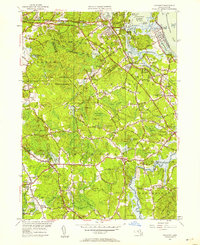
1947 Map of Cohasset
USGS Topo · Published 1958About this map
Cohasset Harbor and the rugged coastline of Massachusetts Bay dominate this postwar survey, revealing a landscape defined by its maritime heritage and the encroaching New York New Haven and Hartford railroad. The map details numerous family-named landmarks and local crossroads such as Manson Corner and Sherman Corner, while the interior shows the extensive United States Naval Reservation and protected tracts like Whitney Woods.
Find a feature on this map
116 named features on this map. Tap any name to fly to it.
Don’t see what you’re looking for? This feature index may not catch every label — zoom into the map to look around manually.
Map Details
Editions of this 1947 Cohasset Map
This is the sole edition of this map. No revisions or reprints were ever made.
Other maps of this area

1885 · Abington
USGS Topo · 1:62,500

1885 · Duxbury
USGS Topo · 1:62,500

1888 · Duxbury
USGS Topo · 1:62,500

1888 · Abington
USGS Topo · 1:62,500

1892 · Boston Bay
USGS Topo · 1:62,500

1893 · Abington
USGS Topo · 1:62,500

1893 · Duxbury
USGS Topo · 1:62,500

1903 · Boston Bay
USGS Topo · 1:62,500

1918 · Duxbury
USGS Topo · 1:62,500

1920 · Abington
USGS Topo · 1:62,500