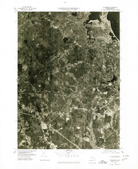
1977 Map of Cohasset
USGS Topo · Published 1980About this map
Massachusetts Bay meets the rocky South Shore in this 1977 aerial study, revealing the dense woodland and coastal development pattern of the late seventies. The orthophoto format provides a literal ground-view of the landscape as it transitioned from traditional rural outposts like Beechwood to the more established suburban centers of Cohasset and North Scituate. Unlike a line-drawn map, this imagery allows for the direct observation of individual property clearings and the winding paths of the Weir River and North River.
Find a feature on this map
10 named features on this map. Tap any name to fly to it.
Don’t see what you’re looking for? This feature index may not catch every label — zoom into the map to look around manually.
Map Details
Editions of this 1977 Cohasset Map
This is the sole edition of this map. No revisions or reprints were ever made.
Other maps of this area

1885 · Abington
USGS Topo · 1:62,500

1885 · Duxbury
USGS Topo · 1:62,500

1888 · Duxbury
USGS Topo · 1:62,500

1888 · Abington
USGS Topo · 1:62,500

1892 · Boston Bay
USGS Topo · 1:62,500

1893 · Abington
USGS Topo · 1:62,500

1893 · Duxbury
USGS Topo · 1:62,500

1903 · Boston Bay
USGS Topo · 1:62,500

1918 · Duxbury
USGS Topo · 1:62,500

1920 · Abington
USGS Topo · 1:62,500