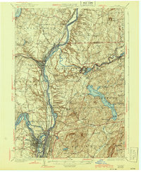
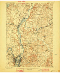
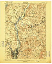
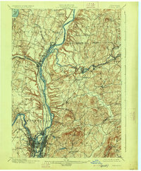
1898 Map of Cohoes
USGS Topo · Published 1905About this map
Hudson River and Mohawk River geography dominates this late 19th-century survey, revealing a landscape defined by industrial waterway transport and revolutionary history. Near the northern edge, the Saratoga Battlefield at Bemis Heights marks a site of national importance, while the river corridors below are dense with infrastructure. The confluence at Cohoes showcases the complex engineering of the Erie Canal and Champlain Canal systems, complete with numerous locks and river crossings. This map captures the region at its industrial peak, where river power at Cohoes Falls and extensive rail networks like the Fitchburg R. R. fueled the growth of manufacturing hubs. The detailed mapping of island clusters including Peobles Id. and Van Schaick Id. provides a precise view of the original river topography before modern industrial and urban alterations changed the character of the waterfronts.
Find a feature on this map
71 named features on this map. Tap any name to fly to it.
Don’t see what you’re looking for? This feature index may not catch every label — zoom into the map to look around manually.
Map Details
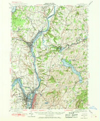
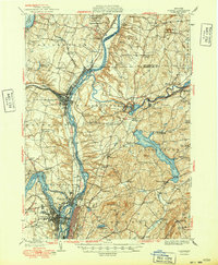
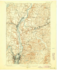
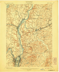
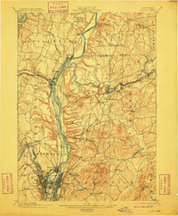
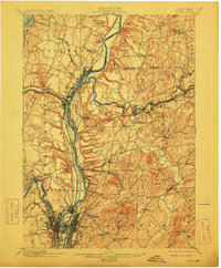
Editions of this 1898 Cohoes Map
8 editions found

Historical Maps of Colonie Through Time
6 maps found