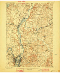
1898 Map of Cohoes
USGS Topo · Published 1901About this map
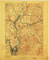
The Hudson River serves as the central artery for this late 19th-century industrial and transport hub, where the confluence with the Mohawk River shapes a complex landscape of islands and hydraulic power. In the city of Cohoes, the dramatic Cohoes Falls and a network of reservoirs support a dense urban grid, while the Erie Canal and Champlain Canal parallel the rivers, highlighting the era's reliance on waterborne commerce. To the north, the Saratoga Battlefield occupies the heights above the Hudson, preserving the ground of a pivotal Revolutionary War site near Bemis Heights. The map also documents a heavy concentration of rail infrastructure, including the Fitchburg R.R. and the Delaware and Hudson R.R., which link manufacturing centers like Mechanicsville and Schaghticoke to the broader regional economy.
Find a feature on this map
68 named features on this map. Tap any name to fly to it.
Don’t see what you’re looking for? This feature index may not catch every label — zoom into the map to look around manually.
Map Details
Editions of this 1898 Cohoes Map
8 editions found

Other maps of this area

1888 · Berlin
USGS Topo · 1:62,500

1890 · Berlin
USGS Topo · 1:62,500

1893 · Cohoes
USGS Topo · 1:62,500

1893 · Troy
USGS Topo · 1:62,500

1893 · Schenectady
USGS Topo · 1:62,500

1893 · Albany
USGS Topo · 1:62,500

1894 · Berlin
USGS Topo · 1:62,500

1895 · Troy
USGS Topo · 1:62,500

1895 · Cohoes
USGS Topo · 1:62,500

1895 · Albany
USGS Topo · 1:62,500