
1911 Map of Cohutta Mtn
USGS Topo · Published 1911About this map
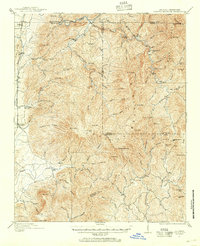
Cohutta Mountain dominates this 1911 survey of the borderlands between Georgia and Tennessee, where the landscape is defined by the headwaters of the Conasauga River and Jacks River. Along the western edge, the Louisville & Nashville RR facilitates commerce for small settlements like Tennga, Fairy, and Crandall. This era shows a mountain economy tied to timber and milling, evidenced by the presence of Hassler Mill on Holly Creek and multiple water features named for local industries, such as Hickory Mill Creek and Mill Branch. The complex terrain includes numerous named peaks and gaps, including the uniquely named Potatopatch Mtn, Rich Knob, and Sassafras Gap. The intricate network of branches and coves, like Lust Cove Branch and Sugar Cove Creek, reflects a deeply dissected topography where family-named landmarks and small-scale operations were the primary markers of human activity before modern development.
Find a feature on this map
85 named features on this map. Tap any name to fly to it.
Don’t see what you’re looking for? This feature index may not catch every label — zoom into the map to look around manually.
Map Details
Editions of this 1911 Cohutta Mtn Map
2 editions found
Other maps of this area

1886 · Dalton
USGS Topo · 1:125,000

1886 · Cleveland
USGS Topo · 1:125,000

1888 · Ellijay
USGS Topo · 1:125,000

1892 · Cleveland
USGS Topo · 1:125,000

1892 · Ellijay
USGS Topo · 1:125,000

1892 · Dalton
USGS Topo · 1:125,000

1893 · Murphy
USGS Topo · 1:125,000

1895 · Cleveland
USGS Topo · 1:125,000

1897 · Dalton
USGS Topo · 1:125,000

1898 · Ellijay
USGS Topo · 1:125,000