2024 Map of Coker
USGS Topo · Published 2024About this map
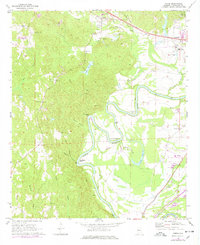
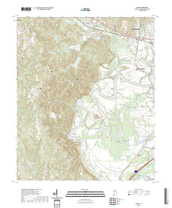
The Black Warrior River carves a deep, winding path through this portion of Tuscaloosa County, defining the landscape with its dramatic oxbows and bends. Significant river features like Robinson Bend, Snows Bend, and Clement Bend illustrate the hydrological force of the waterway, while Sanders Ferry suggests historical points of river crossing before modern infrastructure. The terrain is characterized by steep ravines and ridges, notably around Taylor Gulch and Twelvemile Rock, which separate the river valley from the higher plateaus.
Find a feature on this map
114 named features on this map. Tap any name to fly to it.
Don’t see what you’re looking for? This feature index may not catch every label — zoom into the map to look around manually.
Map Details
Editions of this 2024 Coker Map
This is the sole edition of this map. No revisions or reprints were ever made.