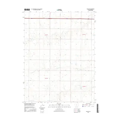
2015 Map of Colby SW
USGS Topo · Published 2015About this map
The N Fork Solomon River and S Fork Solomon River define the undulating landscape of this Thomas County region. The map captures a high-plains environment dominated by watercourses that dictate the local topography, including Prairie Dog Cr in the northern reaches. This 2015 survey illustrates a meticulous grid of rural infrastructure, where a network of county roads like Co Rd 11 and Co Rd 12 provides access across the townships. The drainage patterns of the Solomon River forks are clearly visible, illustrating the vital role these waterways play in the agricultural geography of the Kansas plains. This survey serves as a precise record of the land's contours and the intersection of modern road systems with natural water features.
Find a feature on this map
21 named features on this map. Tap any name to fly to it.
Don’t see what you’re looking for? This feature index may not catch every label — zoom into the map to look around manually.
Map Details
Editions of this 2015 Colby SW Map
This is the sole edition of this map. No revisions or reprints were ever made.
Other maps of this area

1943 · Colby
USGS Topo · 1:62,500

1954 · Goodland
USGS Topo · 1:250,000

1956 · Goodland
USGS Topo · 1:250,000

1957 · Goodland
USGS Topo · 1:250,000

1966 · Brewster SE
USGS Topo · 1:24,000

1967 · Brewster NE
USGS Topo · 1:24,000

1967 · Colby SE
USGS Topo · 1:24,000

1967 · Levant
USGS Topo · 1:24,000

1967 · Colby SW
USGS Topo · 1:24,000

1967 · Colby
USGS Topo · 1:24,000