
1948 Map of Colchester
USGS Topo · Published 1987About this map
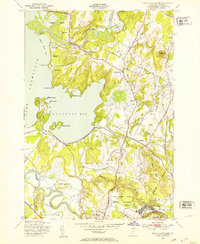
Fort Ethan Allen Military Reservation anchors the southeastern corner of this landscape, reflecting the military presence in Chittenden County during the post-war era. To the north, the Lamoille River winds through agricultural lands toward the Sand Bar National Waterfowl Management Area at the edge of Lake Champlain. The map captures a transition from traditional rural patterns, evidenced by the Town Farm and various numbered schoolhouses like School No 3 and School No 4, to mid-century modernizations including a Drive-in Theater and the early alignment of Interchange 17. The rail-focused economy is marked by the Central Vermont line, while the coastline of Malletts Bay shows established summer institutions such as Camp Kiniya and Braeloch Camp, alongside productive lands like the Winnisquam Orchard.
Find a feature on this map
51 named features on this map. Tap any name to fly to it.
Don’t see what you’re looking for? This feature index may not catch every label — zoom into the map to look around manually.
Map Details
Editions of this 1948 Colchester Map
4 editions found
Other maps of this area

1894 · Plattsburg
USGS Topo · 1:62,500

1895 · Willsboro
USGS Topo · 1:62,500

1906 · Plattsburg
USGS Topo · 1:62,500

1906 · Burlington
USGS Topo · 1:62,500

1913 · Milton
USGS Topo · 1:48,000

1915 · Milton
USGS Topo · 1:62,500

1919 · Burlington
USGS Topo · 1:62,500

1939 · Plattsburg
USGS Topo · 1:62,500

1941 · Plattsburg
USGS Topo · 1:62,500

1941 · Willsboro
USGS Topo · 1:62,500