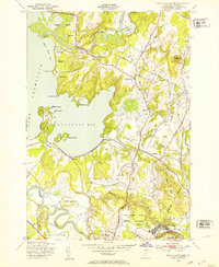
1948 Map of Fort Ethan Allen
USGS Topo · Published 1953About this map
Fort Ethan Allen Military Reservation anchors the southeastern landscape of this late 1940s survey, illustrating the military footprint in the Burlington periphery. The terrain is defined by the sweeping reach of Lake Champlain and the intricate shoreline of Malletts Bay, where several recreational and youth camps such as Camp Norfleet and Camp Kimya reflect the area's development as a summer destination. Inland, the town of Colchester serves as a central hub, connected by the Central Vermont railroad and surrounded by a patchwork of rural landmarks.
Find a feature on this map
52 named features on this map. Tap any name to fly to it.
Don’t see what you’re looking for? This feature index may not catch every label — zoom into the map to look around manually.
Map Details
Editions of this 1948 Fort Ethan Allen Map
4 editions found

Other maps of this area

1894 · Plattsburg
USGS Topo · 1:62,500

1895 · Willsboro
USGS Topo · 1:62,500

1906 · Plattsburg
USGS Topo · 1:62,500

1906 · Burlington
USGS Topo · 1:62,500

1913 · Milton
USGS Topo · 1:48,000

1915 · Milton
USGS Topo · 1:62,500

1919 · Burlington
USGS Topo · 1:62,500

1939 · Plattsburg
USGS Topo · 1:62,500

1941 · Plattsburg
USGS Topo · 1:62,500

1941 · Willsboro
USGS Topo · 1:62,500