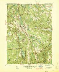
1945 Map of Colchester
USGS Topo · Published 1945About this map
Colchester serves as the central hub of this 1940s landscape, where several key regional roads converge amidst a patchwork of swamps and hills. The map illustrates a transitional period in eastern Connecticut, showing the village center surrounded by outlying agrarian and residential clusters like Amston and Cherry Corners. Significant wetlands, including Dutton Swamp and McDonald Swamp, dictate the local drainage patterns into the Salmon River and Deep River.
Find a feature on this map
51 named features on this map. Tap any name to fly to it.
Don’t see what you’re looking for? This feature index may not catch every label — zoom into the map to look around manually.
Map Details
Editions of this 1945 Colchester Map
2 editions found
Other maps of this area

1892 · New London
USGS Topo · 1:62,500

1892 · Norwich
USGS Topo · 1:62,500

1892 · Gilead
USGS Topo · 1:62,500

1893 · New London
USGS Topo · 1:62,500

1893 · Saybrook
USGS Topo · 1:62,500

1921 · New London
USGS Topo · 1:62,500

1935 · Montville
USGS Topo · 1:24,000

1939 · Montville
USGS Topo · 1:31,680

1943 · Fitchville
USGS Topo · 1:31,680

1944 · Marlboro
USGS Topo · 1:31,680