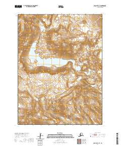
2020 Map of Cold Bay B-1 SE
USGS Topo · Published 2020About this map
Mt Emmons dominates the central landscape of this section of the Alaska Peninsula, rising as a prominent volcanic peak within the Aleutian Range. The caldera of this massif contains Emmons Lake, a significant high-altitude water body that defines the local drainage and topography. To the northwest, the jagged volcanic spires of the Aghileen Pinnacles create a stark contrast to the surrounding ice and ash-covered slopes. This 2020 survey provides an exact record of glacial and volcanic terrain, showing the relationship between these sharp summits and the broad glacial valleys that extend toward the coast. The map is a precise study of geological features and wilderness boundaries in one of the most geologically active regions of the state.
Find a feature on this map
11 named features on this map. Tap any name to fly to it.
Don’t see what you’re looking for? This feature index may not catch every label — zoom into the map to look around manually.
Map Details
Editions of this 2020 Cold Bay B-1 SE Map
This is the sole edition of this map. No revisions or reprints were ever made.
Other maps of this area

1943 · Fort Randall
USGS Topo · 1:250,000

1949 · Fort Randall
USGS Topo · 1:250,000

1950 · Fort Randall
USGS Topo · 1:250,000

1953 · Port Moller
USGS Topo · 1:250,000

1963 · Port Moller A-6
USGS Topo · 1:63,360

1983 · Port Moller B-6
USGS Topo · 1:63,360
1983 · Cold Bay A-1
USGS Topo · 1:63,360
1983 · Cold Bay B-1
USGS Topo · 1:63,360

1988 · Port Moller
USGS Topo · 1:250,000
2020 · Cold Bay B-1 NW
USGS Topo · 1:25,000