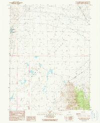
1990 Map of Cold Creek Ranch
USGS Topo · Published 1990About this map
Cold Creek Ranch anchors this high-desert landscape within the Newark Valley, where the transition from arid flats to the rising Ruby Mountains dictates the local water economy. The map details a complex network of seasonal resources, including various Spring sites and a Well that support the ranching operations near the Cold Creek Reservoir. To the south, the expansive Newark Lake Flat (Alkali) illustrates the remnants of prehistoric water systems, characteristic of the Great Basin's terminal sinks.
Find a feature on this map
13 named features on this map. Tap any name to fly to it.
Don’t see what you’re looking for? This feature index may not catch every label — zoom into the map to look around manually.
Map Details
Editions of this 1990 Cold Creek Ranch Map
This is the sole edition of this map. No revisions or reprints were ever made.
Other maps of this area

1953 · Eureka
USGS Topo · 1:62,500

1956 · Ely
USGS Topo · 1:250,000

1957 · Buck Mountain
USGS Topo · 1:62,500

1957 · Diamond Springs
USGS Topo · 1:62,500

1957 · Cold Creek Ranch
USGS Topo · 1:62,500

1959 · Ely
USGS Topo · 1:250,000

1963 · Ely
USGS Topo · 1:250,000

1985 · Newark Lake
USGS Topo · 1:100,000
1990 · Buck Mountain East
USGS Topo · 1:24,000
1990 · Diamond Springs
USGS Topo · 1:24,000