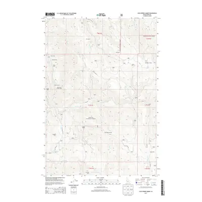
2013 Map of Cold Spring Summit
USGS Topo · Published 2013About this map
Payette National Forest dominates this Idaho mountain landscape, where complex drainage systems define the rugged terrain of Adams County. The divide between the Little Salmon River in the northeast and the E Fork Weiser River to the south reveals a network of canyons and ridges, including the prominent Ft Hall Ridge and Blue Bunch Ridge. Historical transport routes such as the Old Cascade Rd and Nat For Dev Rd 183 navigate these steep grades, providing access to remote landmarks like Cutoff Saddle and Cold Spring Summit.
Find a feature on this map
42 named features on this map. Tap any name to fly to it.
Don’t see what you’re looking for? This feature index may not catch every label — zoom into the map to look around manually.
Map Details
Editions of this 2013 Cold Spring Summit Map
This is the sole edition of this map. No revisions or reprints were ever made.
Other maps of this area

1911 · Meadows
USGS Topo · 1:125,000

1954 · Council
USGS Topo · 1:62,500

1954 · New Meadows
USGS Topo · 1:62,500

1954 · Cascade
USGS Topo · 1:62,500

1955 · Baker
USGS Topo · 1:250,000

1959 · Baker
USGS Topo · 1:250,000
1973 · Meadows
USGS Topo · 1:24,000
1973 · No Business Mtn
USGS Topo · 1:24,000

1980 · McCall
USGS Topo · 1:100,000
1985 · Lone Tree
USGS Topo · 1:24,000