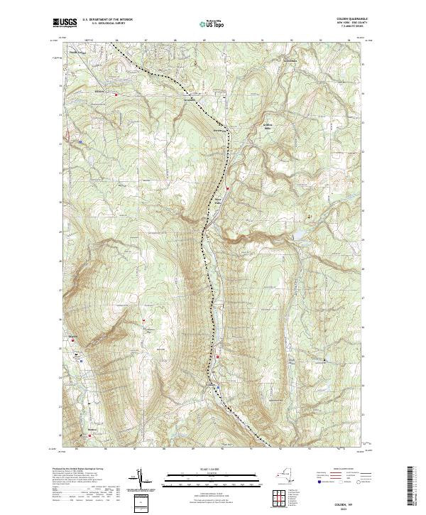
2023 Map of Colden
USGS Topo · Published 2023About this map
The West Branch Cazenovia Creek carves a central path through this landscape, anchoring a series of small hamlets and rural crossroads. The settlement pattern is defined by historic pockets like Griffins Mills and Jewettville in the north, while Colden serves as a primary southern hub. The topography is notably marked by a series of dramatic ravines and heights, including Big Gulf, Irish Gulf, and Anthony Gulf on the western flank, contrasting with the prominent rise of East Boston Hill. For researchers of local families, the presence of several established burial grounds such as Maple Wood Cem and Partridge Cem provides concrete points of reference. The map also captures infrastructure like the Orchard Park Reservoir and the network of county roads that stitch together these upland communities.
Find a feature on this map
75 named features on this map. Tap any name to fly to it.
Don’t see what you’re looking for? This feature index may not catch every label — zoom into the map to look around manually.
Map Details
Editions of this 2023 Colden Map
This is the sole edition of this map. No revisions or reprints were ever made.
Other maps of this area

1894 · Buffalo
USGS Topo · 1:62,500

1901 · Buffalo
USGS Topo · 1:62,500

1905 · Depew
USGS Topo · 1:62,500

1905 · Eden
USGS Topo · 1:62,500

1907 · Eden
USGS Topo · 1:62,500

1925 · Springville
USGS Topo · 1:62,500

1944 · Eden
USGS Topo · 1:62,500

1944 · Hamburg
USGS Topo · 1:31,680

1944 · Langford
USGS Topo · 1:31,680

1948 · Hamburg
USGS Topo · 1:24,000