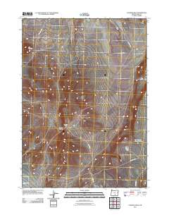
2011 Map of Coleman Hills
USGS Topo · Published 2011About this map
Jug Mountain anchors the high ground in this 2011 survey of Lake County, where the high desert terrain transitions between the Coleman Hills and the open expanse of Coleman Flat. The landscape is defined by its isolation and the practical infrastructure of rural Oregon, with the Rock Spring Gulch Reservoir providing a critical water source in an otherwise arid region. Grounded in the high plains, the area is navigated by a network of descriptive routes including Jug Mountain Rd and Corn Lake Rd. A prominent topographic feature, the Hogback Summit, marks a significant elevation point along the Hogback Rd corridor, illustrating the distinctive volcanic and tectonic geology that shapes this part of the state.
Find a feature on this map
11 named features on this map. Tap any name to fly to it.
Don’t see what you’re looking for? This feature index may not catch every label — zoom into the map to look around manually.
Map Details
Editions of this 2011 Coleman Hills Map
This is the sole edition of this map. No revisions or reprints were ever made.
Other maps of this area

1955 · Klamath Falls
USGS Topo · 1:250,000

1955 · Adel
USGS Topo · 1:250,000

1957 · Adel
USGS Topo · 1:250,000

1958 · Klamath Falls
USGS Topo · 1:250,000

1958 · Adel
USGS Topo · 1:250,000

1962 · Adel
USGS Topo · 1:250,000

1966 · Rabbit Hills NW
USGS Topo · 1:24,000

1968 · Lake Abert North
USGS Topo · 1:24,000

1968 · Commodore Ridge
USGS Topo · 1:24,000

1974 · Lake Abert
USGS Topo · 1:100,000