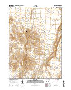
2014 Map of Coleman Hills
USGS Topo · Published 2014About this map
Coleman Hills and the surrounding high desert terrain dominate this Lake County landscape as it appeared in the early 21st century. The map centers on the Lakeview-Burns Hwy, which cuts diagonally through the region, connecting remote basins and summits. Elevation peaks at the Hogback Summit and Jug Mtn, while the expansive Abert Seeding area reflects land management practices in this arid environment. Significant geographic landmarks such as Poverty Basin and Coleman Flat are clearly delineated, illustrating the varied topography of the Great Basin. Small-scale water management is visible at Rock Spring Gulch Reservoir, a critical resource in this dry livestock and wildlife range. The road network is sparse, consisting mainly of the highway and secondary routes like Hogback Rd and Corn Lake Rd, serving isolated ranching or conservation interests.
Find a feature on this map
20 named features on this map. Tap any name to fly to it.
Don’t see what you’re looking for? This feature index may not catch every label — zoom into the map to look around manually.
Map Details
Editions of this 2014 Coleman Hills Map
This is the sole edition of this map. No revisions or reprints were ever made.
Other maps of this area

1955 · Klamath Falls
USGS Topo · 1:250,000

1955 · Adel
USGS Topo · 1:250,000

1957 · Adel
USGS Topo · 1:250,000

1958 · Klamath Falls
USGS Topo · 1:250,000

1958 · Adel
USGS Topo · 1:250,000

1962 · Adel
USGS Topo · 1:250,000

1966 · Rabbit Hills NW
USGS Topo · 1:24,000

1968 · Lake Abert North
USGS Topo · 1:24,000

1968 · Commodore Ridge
USGS Topo · 1:24,000

1974 · Lake Abert
USGS Topo · 1:100,000