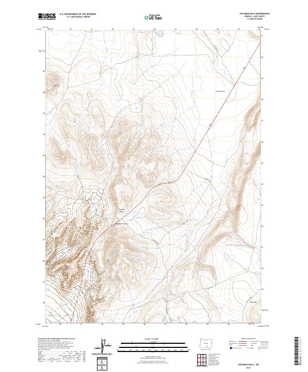
2023 Map of Coleman Hills
USGS Topo · Published 2023About this map
The Coleman Hills and surrounding high desert terrain dominate this part of Lake County, where the landscape is defined by volcanic features and high-altitude basins. Centrally located, Hogback Summit serves as a prominent landmark along Hogback Rd, while to the northwest, the distinct peak of Jug Mtn rises above the sagebrush. This region is characterized by expansive cattle ranching and land management infrastructure, including Leeman Well and several unnamed springs.
Find a feature on this map
16 named features on this map. Tap any name to fly to it.
Don’t see what you’re looking for? This feature index may not catch every label — zoom into the map to look around manually.
Map Details
Editions of this 2023 Coleman Hills Map
This is the sole edition of this map. No revisions or reprints were ever made.
Other maps of this area

1955 · Klamath Falls
USGS Topo · 1:250,000

1955 · Adel
USGS Topo · 1:250,000

1957 · Adel
USGS Topo · 1:250,000

1958 · Klamath Falls
USGS Topo · 1:250,000

1958 · Adel
USGS Topo · 1:250,000

1962 · Adel
USGS Topo · 1:250,000

1966 · Rabbit Hills NW
USGS Topo · 1:24,000

1968 · Lake Abert North
USGS Topo · 1:24,000

1968 · Commodore Ridge
USGS Topo · 1:24,000

1974 · Lake Abert
USGS Topo · 1:100,000