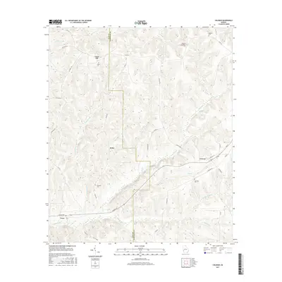
2017 Map of Coleman
USGS Topo · Published 2017About this map
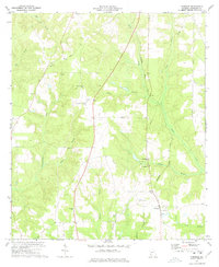
Coleman and the surrounding rural landscape of Randolph and Clay Counties are defined by a network of creeks and ridge-top settlements. The topography is shaped by significant watercourses including Cemochechobee Cr, Waukefiskee Cr, and Hog Creek, which carve through the terrain between prominent high points like Hunters Rdg. This 2017 survey illustrates the persistent agricultural and community patterns of southwest Georgia, where small hubs like Cotton Hill, Bethel, and Pecan remain anchored by their local institutions. Genealogists will find a wealth of burial records documented across the quadrangle, from the Pleasant Hill Baptist Church Cem in the northeast to the Singletary Cem near Bethel and the Shiloh Cem further north. The map also traces the winding paths of rural infrastructure such as Days Cross Rd and Cottonhill Rd, reflecting generations of land use and transit in the wiregrass region.
Find a feature on this map
53 named features on this map. Tap any name to fly to it.
Don’t see what you’re looking for? This feature index may not catch every label — zoom into the map to look around manually.
Map Details
Editions of this 2017 Coleman Map
This is the sole edition of this map. No revisions or reprints were ever made.
Other maps of this area

1953 · Dothan
USGS Topo · 1:250,000

1954 · Dothan
USGS Topo · 1:250,000

1955 · Dothan
USGS Topo · 1:250,000

1967 · Hatcher
USGS Topo · 1:24,000

1969 · Fort Gaines
USGS Topo · 1:24,000

1969 · Fort Gaines NE
USGS Topo · 1:24,000
1972 · Cuthbert
USGS Topo · 1:24,000
1973 · Morris
USGS Topo · 1:24,000
1973 · Coleman
USGS Topo · 1:24,000
1973 · Carnegie
USGS Topo · 1:24,000