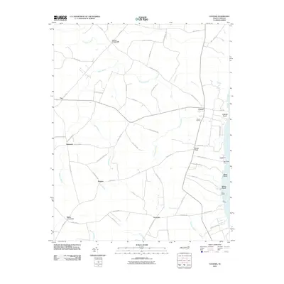
2010 Map of Colerain
USGS Topo · Published 2010About this map
The Chowan River shoreline defines the eastern edge of this Bertie County landscape, where small landings and beaches like Colerain Beach, Marys Beach, and Whites Beach meet the water. Inland, the terrain is a complex network of wetlands and drainage basins, notably Chinkapin Swamp, Cypress Swamp, and Barbeque Swamp. These wetlands dictate the placement of local settlements, which are primarily concentrated at high-ground intersections such as Glovers Crossroads, Trap, and Whites Crossroads.
Find a feature on this map
63 named features on this map. Tap any name to fly to it.
Don’t see what you’re looking for? This feature index may not catch every label — zoom into the map to look around manually.
Map Details
Editions of this 2010 Colerain Map
This is the sole edition of this map. No revisions or reprints were ever made.
Other maps of this area

1904 · Edenton
USGS Topo · 1:62,500

1906 · Beckford
USGS Topo · 1:48,000

1907 · Beckford
USGS Topo · 1:62,500

1908 · Winton
USGS Topo · 1:62,500

1940 · Beckford
USGS Topo · 1:62,500

1942 · Edenton
USGS Topo · 1:62,500

1943 · Edenton
USGS Topo · 1:62,500

1953 · Norfolk
USGS Topo · 1:250,000
1981 · Windsor North
USGS Topo · 1:24,000

1982 · Powellsville
USGS Topo · 1:24,000