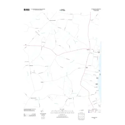
2013 Map of Colerain
USGS Topo · Published 2013About this map
Colerain and the eastern edge of Bertie County are defined by the expansive Chowan River and a network of named wetlands that crisscross the agricultural landscape. The township of Colerain serves as the primary hub, while numerous smaller crossroads such as Glovers Crossroads, Trap, and Whites Crossroads signify the dispersed rural settlement patterns typical of this North Carolina coastal plain region.
Find a feature on this map
85 named features on this map. Tap any name to fly to it.
Don’t see what you’re looking for? This feature index may not catch every label — zoom into the map to look around manually.
Map Details
Editions of this 2013 Colerain Map
This is the sole edition of this map. No revisions or reprints were ever made.
Other maps of this area

1904 · Edenton
USGS Topo · 1:62,500

1906 · Beckford
USGS Topo · 1:48,000

1907 · Beckford
USGS Topo · 1:62,500

1908 · Winton
USGS Topo · 1:62,500

1940 · Beckford
USGS Topo · 1:62,500

1942 · Edenton
USGS Topo · 1:62,500

1943 · Edenton
USGS Topo · 1:62,500

1953 · Norfolk
USGS Topo · 1:250,000
1981 · Windsor North
USGS Topo · 1:24,000

1982 · Powellsville
USGS Topo · 1:24,000