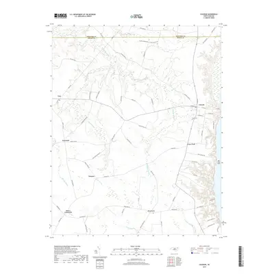
2019 Map of Colerain
USGS Topo · Published 2019About this map
The town of Colerain stands as a primary settlement on this northeastern North Carolina landscape, situated near the banks of the Chowan River. The geography is defined by an extensive network of low-lying wetlands, including the branching reaches of Cypress Swamp, Chinkapin Swamp, and Barbeque Swamp. These hydrological features dictate the historical placement of roads and small communities like Trap, Rosemead, and Wakelon, which are connected by a web of local routes such as Valentine Farm Rd and Northcott Farm Rd.
Find a feature on this map
67 named features on this map. Tap any name to fly to it.
Don’t see what you’re looking for? This feature index may not catch every label — zoom into the map to look around manually.
Map Details
Editions of this 2019 Colerain Map
This is the sole edition of this map. No revisions or reprints were ever made.
Other maps of this area

1904 · Edenton
USGS Topo · 1:62,500

1906 · Beckford
USGS Topo · 1:48,000

1907 · Beckford
USGS Topo · 1:62,500

1908 · Winton
USGS Topo · 1:62,500

1940 · Beckford
USGS Topo · 1:62,500

1942 · Edenton
USGS Topo · 1:62,500

1943 · Edenton
USGS Topo · 1:62,500

1953 · Norfolk
USGS Topo · 1:250,000
1981 · Windsor North
USGS Topo · 1:24,000

1982 · Powellsville
USGS Topo · 1:24,000