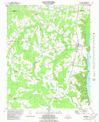
1982 Map of Colerain
USGS Topo · Published 1982About this map
The Chowan River defines the eastern boundary of this Bertie County landscape, where the settlement of Colerain serves as the primary hub along the riverbanks. The interior is a mosaic of agricultural clearings and dense swamp drainage systems, including the extensive Cypress Swamp, Chinkapin Swamp, and Barbecue Swamp. This 1982 map reveals a deeply rooted community structure, evidenced by the numerous country churches and crossroads that anchor the rural landscape. Small hubs such as Glovers Crossroads, Whites Crossroads, and Trap provide local orientation, while the high frequency of family and community cemeteries (marked simply as Cems) highlights the area's genealogical depth.
Find a feature on this map
34 named features on this map. Tap any name to fly to it.
Don’t see what you’re looking for? This feature index may not catch every label — zoom into the map to look around manually.
Map Details
Editions of this 1982 Colerain Map
This is the sole edition of this map. No revisions or reprints were ever made.
Other maps of this area

1904 · Edenton
USGS Topo · 1:62,500

1906 · Beckford
USGS Topo · 1:48,000

1907 · Beckford
USGS Topo · 1:62,500

1908 · Winton
USGS Topo · 1:62,500

1940 · Beckford
USGS Topo · 1:62,500

1942 · Edenton
USGS Topo · 1:62,500

1943 · Edenton
USGS Topo · 1:62,500

1953 · Norfolk
USGS Topo · 1:250,000
1981 · Windsor North
USGS Topo · 1:24,000

1982 · Powellsville
USGS Topo · 1:24,000