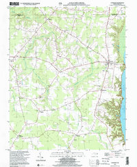
2000 Map of Colerain
USGS Topo · Published 2002About this map
The Chowan River defines the eastern edge of this coastal plain landscape, where the Bertie and Hertford county line meets the water at Bull Pond Point. Inland, the terrain is shaped by a dense network of blackwater drainages including Chinkapin Swamp, Cypress Swamp, and Barbecue Swamp. These wetlands separate elevated reaches of farmland where small crossroads communities and rural congregations have long been established.
Find a feature on this map
32 named features on this map. Tap any name to fly to it.
Don’t see what you’re looking for? This feature index may not catch every label — zoom into the map to look around manually.
Map Details
Editions of this 2000 Colerain Map
This is the sole edition of this map. No revisions or reprints were ever made.
Other maps of this area

1904 · Edenton
USGS Topo · 1:62,500

1906 · Beckford
USGS Topo · 1:48,000

1907 · Beckford
USGS Topo · 1:62,500

1908 · Winton
USGS Topo · 1:62,500

1940 · Beckford
USGS Topo · 1:62,500

1942 · Edenton
USGS Topo · 1:62,500

1943 · Edenton
USGS Topo · 1:62,500

1953 · Norfolk
USGS Topo · 1:250,000
1981 · Windsor North
USGS Topo · 1:24,000

1982 · Powellsville
USGS Topo · 1:24,000