
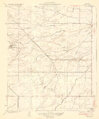
1929 Map of Coles Levee
USGS Topo · Published 1929About this map
The Elk Hills dominate the southwestern corner of this Kern County survey, providing a sharp topographic contrast to the surrounding alluvial plain. This 1920s landscape is defined by an extensive network of water management, where the Kern River and its associated Kern River Slough are redirected through engineered works like the Pioneer Canal and the James and Dixon Canal. This infrastructure supported the regional transition from wild wetlands to structured agricultural and industrial use.
Find a feature on this map
14 named features on this map. Tap any name to fly to it.
Don’t see what you’re looking for? This feature index may not catch every label — zoom into the map to look around manually.
Map Details
Editions of this 1929 Coles Levee Map
This is the sole edition of this map. No revisions or reprints were ever made.
Other maps of this area

1910 · Buena Vista Lake
USGS Topo · 1:125,000

1912 · Buena Vista Lake
USGS Topo · 1:125,000

1929 · Stevens
USGS Topo · 1:31,680

1929 · Mouth of Kern
USGS Topo · 1:31,680

1930 · Millux
USGS Topo · 1:31,680

1930 · Rosedale
USGS Topo · 1:31,680

1931 · Rio Bravo
USGS Topo · 1:31,680

1932 · East Elk Hills
USGS Topo · 1:31,680

1932 · Mouth of Kern
USGS Topo · 1:31,680
1932 · Stevens
USGS Topo · 1:31,680