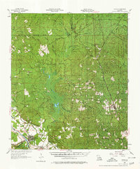
1956 Map of Colfax
USGS Topo · Published 1978About this map
Colfax and its surrounding riverine landscape appear here during a period of transition in the mid-1950s, bounded by the Kansas City Southern railroad and the winding Red River. The map documents the extensive Kisatchie National Forest and the complex hydrology of the region, anchored by the sprawling Lake Iatt and the Rigolette Spillway. Small rural communities and church-centered settlements like Williana, Faircloth, and Summerfield are scattered throughout the piney woods, connected by a network of bayous including Sugarhouse Bayou and Valentine Bayou. Local landmarks such as the Spanish Mound and Vance Lookout Tower provide navigational and historical context for the Grant Parish interior. Genealogists will find numerous rural centers of worship, from Liberty Chapel to Zion Hill Ch, which served as the primary social hubs for these upland timber and farming communities.
Find a feature on this map
77 named features on this map. Tap any name to fly to it.
Don’t see what you’re looking for? This feature index may not catch every label — zoom into the map to look around manually.
Map Details
Editions of this 1956 Colfax Map
3 editions found
Other maps of this area

1932 · Colfax NE
USGS Topo · 1:31,680

1932 · Boyce NE
USGS Topo · 1:31,680

1932 · Colfax SW
USGS Topo · 1:31,680

1932 · Colfax SE
USGS Topo · 1:31,680

1932 · Colfax NW
USGS Topo · 1:31,680

1935 · Verda
USGS Topo · 1:31,680

1936 · Colfax
USGS Topo · 1:62,500

1936 · Pollock
USGS Topo · 1:62,500

1937 · Chopin NE
USGS Topo · 1:31,680

1937 · Aloha
USGS Topo · 1:31,680