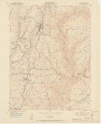
1951 Map of Colfax
USGS Topo · Published 1951About this map
Colfax serves as the central hub of this Gold Country landscape, situated where the Southern Pacific railroad maneuvers through the complex ridges between the Bear River and the North Fork of the American River. The 1949 field survey records a region defined by its industrial past and transit-oriented settlements, including the Illinoistown (Site) and the sprawling Sanatorium at Weimar. Water management is prominent throughout the terrain, evidenced by the Boardman Canal, numerous Siphons, and a Flume network designed to direct water through steep ravines like Cape Horn Ravine.
Find a feature on this map
81 named features on this map. Tap any name to fly to it.
Don’t see what you’re looking for? This feature index may not catch every label — zoom into the map to look around manually.
Map Details
Editions of this 1951 Colfax Map
2 editions found
Other maps of this area

1888 · Smartsville
USGS Topo · 1:125,000

1891 · Sacramento
USGS Topo · 1:125,000

1891 · Colfax
USGS Topo · 1:125,000

1891 · Smartsville
USGS Topo · 1:125,000

1891 · Placerville
USGS Topo · 1:125,000

1892 · Sacramento
USGS Topo · 1:125,000

1892 · Placerville
USGS Topo · 1:125,000

1892 · Smartsville
USGS Topo · 1:125,000

1892 · Colfax
USGS Topo · 1:125,000

1893 · Placerville
USGS Topo · 1:125,000