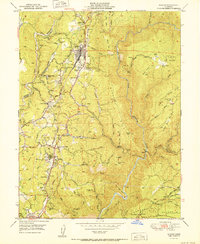
1951 Map of Colfax
USGS Topo · Published 1951About this map
The Southern Pacific railroad corridor serves as the central spine of this Gold Country landscape, connecting the vital mountain hub of Colfax with established settlements like Weimar and Applegate. This 1951 edition highlights a transition in the region's history, noting the Illinoistown (Site) near the Historic Marker, indicating the early American settlement that preceded the railroad's arrival.
Find a feature on this map
83 named features on this map. Tap any name to fly to it.
Don’t see what you’re looking for? This feature index may not catch every label — zoom into the map to look around manually.
Map Details
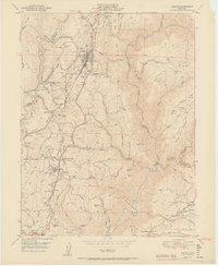
Editions of this 1951 Colfax Map
2 editions found
Other maps of this area

1888 · Smartsville
USGS Topo · 1:125,000

1891 · Sacramento
USGS Topo · 1:125,000

1891 · Colfax
USGS Topo · 1:125,000

1891 · Smartsville
USGS Topo · 1:125,000

1891 · Placerville
USGS Topo · 1:125,000

1892 · Sacramento
USGS Topo · 1:125,000

1892 · Placerville
USGS Topo · 1:125,000

1892 · Smartsville
USGS Topo · 1:125,000

1892 · Colfax
USGS Topo · 1:125,000

1893 · Placerville
USGS Topo · 1:125,000