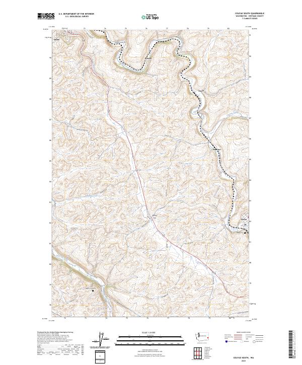
2023 Map of Colfax South
USGS Topo · Published 2023About this map
The South Fork Palouse River carves a deep path through the rolling hills of Whitman County, anchoring a landscape defined by its network of watercourses and agricultural settlements. In the northwestern corner, the town of Colfax sits near the river's bend, while smaller rural communities like Spring Flat, Risbeck, and Shawnee are distributed across the upland terrain. These settlements are connected by a dense web of roads often named for local families or destinations, such as Enman-Kincaid Rd and Albion Parvin Rd, reflecting the ingrained history of land ownership and transport in this corner of the Palouse.
Find a feature on this map
38 named features on this map. Tap any name to fly to it.
Don’t see what you’re looking for? This feature index may not catch every label — zoom into the map to look around manually.
Map Details
Editions of this 2023 Colfax South Map
This is the sole edition of this map. No revisions or reprints were ever made.
Other maps of this area

1910 · Pullman
USGS Topo · 1:125,000

1955 · Pullman
USGS Topo · 1:250,000

1958 · Pullman
USGS Topo · 1:250,000

1964 · Diamond
USGS Topo · 1:24,000

1964 · Elberton
USGS Topo · 1:24,000

1964 · Colfax North
USGS Topo · 1:24,000

1964 · Wilcox
USGS Topo · 1:24,000
1964 · Albion
USGS Topo · 1:24,000

1964 · Colfax South
USGS Topo · 1:24,000

1964 · Ewartsville
USGS Topo · 1:24,000