
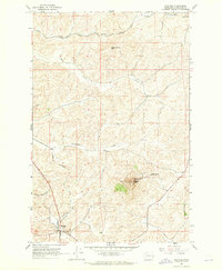
1964 Map of Elberton
USGS Topo · Published 1965About this map
The Palouse River winds through the heart of Whitman County in this mid-1960s survey, illustrating a landscape defined by deep river bends and the infrastructure of the Pacific Northwest's rail era. The settlement of Elberton is situated along the river's northern banks, served by the Union Pacific line, while the Northern Pacific railroad cuts through the northeastern corner of the quadrangle. This area of eastern Washington shows a pattern of high-plateau farming interrupted by drainage systems like Brush Creek and Silver Creek. Local history and genealogy are anchored by the Garfield Cem and Eden Valley Cem, which serve the small communities of Eden Valley and surrounding homesteads. Evidence of early land management remains visible in the numerous benchmarks and bridges, such as BR 2290, that connect the rural road network across the undulating terrain near Turnbow Flat and Silver Springs.
Find a feature on this map
21 named features on this map. Tap any name to fly to it.
Don’t see what you’re looking for? This feature index may not catch every label — zoom into the map to look around manually.
Map Details
Editions of this 1964 Elberton Map
This is the sole edition of this map. No revisions or reprints were ever made.
Other maps of this area

1903 · Oakesdale
USGS Topo · 1:125,000

1905 · Oakesdale
USGS Topo · 1:125,000

1910 · Pullman
USGS Topo · 1:125,000

1955 · Pullman
USGS Topo · 1:250,000

1955 · Spokane
USGS Topo · 1:250,000

1958 · Spokane
USGS Topo · 1:250,000

1958 · Pullman
USGS Topo · 1:250,000

1964 · Viola
USGS Topo · 1:24,000

1964 · Colfax North
USGS Topo · 1:24,000
1964 · Steptoe
USGS Topo · 1:24,000