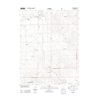
2013 Map of Collbran
USGS Topo · Published 2013About this map
The town of Collbran sits at the confluence of Plateau Creek, Kimball Creek, and Buzzard Creek in the high desert valley of western Colorado. The landscape is defined by the transition from the ranching lands of Plateau Valley and Kansas Mesa toward the soaring elevations of the Grand Mesa National Forest to the south. This 2013 survey details the complex network of irrigation that sustains this arid region, including the Berthold Updyke and London Ditch and the Mormon Mesa Ditch. Local history is preserved in landmarks such as the Parker Basin School and Cedar Crest Cem, while the rugged geography is marked by prominent features like Sugarloaf Peak, The Peninsula, and the oddly named Death Valley near the base of the mesa. The inclusion of the Collbran Job Corps and the Twin Peaks Bible and Missionary Camp reflects the continued community and institutional presence in this high country.
Find a feature on this map
74 named features on this map. Tap any name to fly to it.
Don’t see what you’re looking for? This feature index may not catch every label — zoom into the map to look around manually.
Map Details
Editions of this 2013 Collbran Map
This is the sole edition of this map. No revisions or reprints were ever made.
Other maps of this area

1929 · Grand Valley
USGS Topo · 1:62,500

1955 · Collbran
USGS Topo · 1:24,000

1955 · Grand Mesa
USGS Topo · 1:24,000

1955 · Molina
USGS Topo · 1:24,000

1955 · Skyway
USGS Topo · 1:24,000

1955 · The Meadows
USGS Topo · 1:24,000

1956 · Grand Junction
USGS Topo · 1:250,000

1957 · Leadville
USGS Topo · 1:250,000

1959 · Grand Junction
USGS Topo · 1:250,000

1959 · Leadville
USGS Topo · 1:250,000