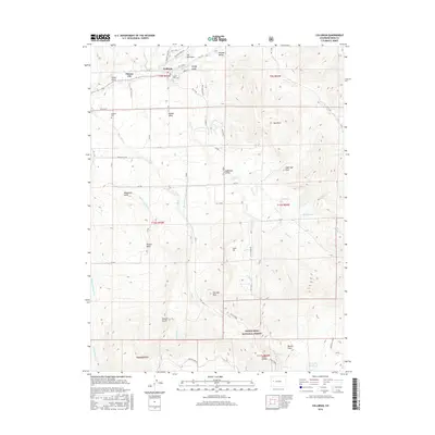
2016 Map of Collbran
USGS Topo · Published 2016About this map
Collbran and Plateau City anchor this high-altitude landscape where the Plateau Valley meets the northern edge of the Grand Mesa National Forest. The map documents a sophisticated irrigation network vital to the region's agricultural history, featuring the Berthold-Updyke and Landon Ditch, Silver Gage Ditch, and Mormon Mesa Ditch. These engineered watercourses follow the contours of the terrain to support homesteads on Kansas Mesa and in Parker Basin. Local history is preserved at Cedar Crest Cem and Eagalite Cem, while the industrial footprint of the Bureau Pipeline cuts across the southern slopes. Topographic landmarks like Old Man Mtn and Sugarloaf Peak overlook a system of gulches and creeks, including Buzzard Cr and Big Cr, that feed the larger Plateau Cr drainage system.
Find a feature on this map
72 named features on this map. Tap any name to fly to it.
Don’t see what you’re looking for? This feature index may not catch every label — zoom into the map to look around manually.
Map Details
Editions of this 2016 Collbran Map
This is the sole edition of this map. No revisions or reprints were ever made.
Other maps of this area

1929 · Grand Valley
USGS Topo · 1:62,500

1955 · Collbran
USGS Topo · 1:24,000

1955 · Grand Mesa
USGS Topo · 1:24,000

1955 · Molina
USGS Topo · 1:24,000

1955 · Skyway
USGS Topo · 1:24,000

1955 · The Meadows
USGS Topo · 1:24,000

1956 · Grand Junction
USGS Topo · 1:250,000

1957 · Leadville
USGS Topo · 1:250,000

1959 · Grand Junction
USGS Topo · 1:250,000

1959 · Leadville
USGS Topo · 1:250,000