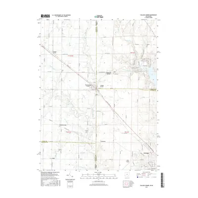
2016 Map of College Corner
USGS Topo · Published 2016About this map
College Corner and its counterpart West College Corner sit directly on the state line, anchoring a landscape where the rural borders of Ohio and Indiana merge. This 2016 survey illustrates a region defined by the drainage of Four Mile Creek and Indian Creek, with the large expanse of Acton Lake visible on the eastern edge. The map reveals a high density of small rural burial grounds, including Hopewell, Keiffer, and Bethlehem cemeteries, which serve as vital markers for local genealogical research. In the southern portion of the quadrangle, the academic and aviation influence of nearby institutions is felt at the Miami University Airport. From the clustered crossroads of Cottage Grove to the southern reach of Oxford, the map documents a stable agricultural and residential pattern along historic routes like Liberty Ave and the College Corner Pike.
Find a feature on this map
108 named features on this map. Tap any name to fly to it.
Don’t see what you’re looking for? This feature index may not catch every label — zoom into the map to look around manually.
Map Details
Editions of this 2016 College Corner Map
This is the sole edition of this map. No revisions or reprints were ever made.
Other maps of this area

1911 · Oxford
USGS Topo · 1:62,500

1915 · College Corner
USGS Topo · 1:48,000

1915 · Harrison
USGS Topo · 1:48,000

1915 · Hamilton
USGS Topo · 1:62,500

1917 · Hamilton
USGS Topo · 1:62,500

1918 · College Corner
USGS Topo · 1:62,500

1948 · Fairfield
USGS Topo · 1:24,000

1953 · Cincinnati
USGS Topo · 1:250,000

1955 · Reily
USGS Topo · 1:24,000

1955 · Mount Carmel
USGS Topo · 1:24,000