
1955 Map of Mount Carmel
USGS Topo · Published 1956About this map
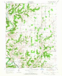
The East Fork Whitewater River carves a deep valley through the northwest of this mid-1950s Indiana landscape, where the confluence of the Whitewater River forms a natural focal point for early infrastructure. The river system is shadowed by the New York Central railroad, while landmarks such as The Mounds and Battle Point suggest a landscape long defined by its high-ground topography and strategic views. The distribution of small rural settlements like Whitcomb and Palestine reveals the agricultural character of the era, supported by a network of country churches including Big Cedar Ch and Little Cedar Grove Ch. Local history is preserved in the placement of the Township Sch and the James Cem, showing the localized community structure of Franklin County before modern consolidation. To the east, the village of Mount Carmel anchors the boundary near the Ohio state line, surrounded by numerous named hills and hollows like Bon Well Hill and Little Owl Hollow.
Find a feature on this map
31 named features on this map. Tap any name to fly to it.
Don’t see what you’re looking for? This feature index may not catch every label — zoom into the map to look around manually.
Map Details
Editions of this 1955 Mount Carmel Map
2 editions found
Other maps of this area

1915 · College Corner
USGS Topo · 1:48,000

1915 · Harrison
USGS Topo · 1:48,000

1918 · College Corner
USGS Topo · 1:62,500

1948 · Fairfield
USGS Topo · 1:24,000

1953 · Cincinnati
USGS Topo · 1:250,000

1955 · Harrison
USGS Topo · 1:24,000

1955 · Reily
USGS Topo · 1:24,000
1955 · Cedar Grove
USGS Topo · 1:24,000

1956 · Everton
USGS Topo · 1:24,000

1956 · Brookville
USGS Topo · 1:24,000