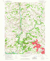
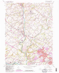
1966 Map of Collegeville
USGS Topo · Published 1968About this map
Ursinus College serves as a prominent landmark in the central borough of Collegeville, surrounded by the burgeoning suburban landscape of Montgomery County in the mid-1960s. The geography is defined by the winding course of Perkiomen Creek, which flows south toward its confluence with the Schuylkill River near Mont Clare and Port Providence. This survey illustrates a complex social landscape, featuring large institutional footprints such as the State Correctional Institution at Graterford, the County Prison Farm, and the Eagleville Sanitarium.
Find a feature on this map
69 named features on this map. Tap any name to fly to it.
Don’t see what you’re looking for? This feature index may not catch every label — zoom into the map to look around manually.
Map Details
Editions of this 1966 Collegeville Map
5 editions found
Other maps of this area

1888 · Quakertown
USGS Topo · 1:62,500

1890 · Quakertown
USGS Topo · 1:62,500

1894 · Quakertown
USGS Topo · 1:62,500

1894 · Norristown
USGS Topo · 1:62,500

1895 · Norristown
USGS Topo · 1:62,500

1896 · Norristown
USGS Topo · 1:62,500

1902 · Boyertown
USGS Topo · 1:62,500

1906 · Phoenixville
USGS Topo · 1:62,500

1942 · Norristown
USGS Topo · 1:125,000
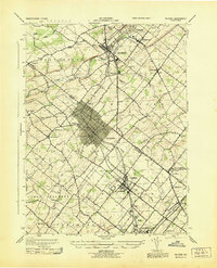
1943 · Telford
USGS Topo · 1:31,680
Featured Places
- Limerick Township, PA
- Phoenixville, PA
- Skippack Township, PA
- Worcester Township, PA
- Perkiomen Township, PA